



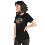
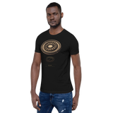
Arkaim Site-Emblem T-Shirt, Russia
Size guideUnisex fit, Bella+Canvas 3001. See the measurements
| Size | Length | Width |
|---|---|---|
| S | 71 cm · 28 in | 46 cm · 18 in |
| M | 74 cm · 29 in | 51 cm · 20 in |
| L | 76 cm · 30 in | 56 cm · 22 in |
| XL | 79 cm · 31 in | 61 cm · 24 in |
| 2XL | 81 cm · 32 in | 66 cm · 26 in |
Arkaim: the Bronze Age ring settlement of the southern Urals seen from above, its circular walls and wedge-shaped houses around a central square, over a fine-line diagram of rings and sightlines. Printed beneath: the site name, country and coordinates.
- Aerial view of Arkaim's ring walls and wedge-shaped houses, drawn in colour
- Fine-line diagram of the rings and their sightlines
- Site name, country and coordinates printed beneath, from Pyramason's own catalogue
- Bella + Canvas 3001 unisex tee in black: 100% combed and ring-spun cotton, 4.2 oz, retail fit, sizes S to 2XL, printed to order
Why this site. In our first run, of August 2026, the golden ratio cleared significance at six of fifty sites, and five of those collapsed the moment you checked the control, because an arbitrary ratio did just as well; Arkaim was the one that did not. Our improved chance model of October 2026 is stricter: only one of the fifty sites now clears the usual line, the Acropolis, where a control ties it, and Arkaim falls just short at p = 0.0565. It still has the golden ratio's widest lead over the controls, 2.50 times its expected count against 1.33 for the best control, and it still rests on a six-site sample, which is thin, so we call it worth a closer look rather than a discovery. That distinction is the whole point of this atlas.
Arkaim · Russia · 52°38'57.0"N 59°34'17.1"E