

Teotihuacan Site-Emblem T-Shirt, Mexico
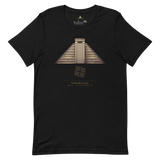
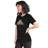
A monument portrait of the Pyramid of the Sun paired with the geometry diagram Pyramason actually ran across the Basin of Mexico: 52 golden-ratio pairs against 37.7 expected, p = 0.0810. Elevated, but short of significance. Printed beneath: Teotihuacan, Mexico, 19.6925, -98.843889, from our own database.
- Monument illustration of the Pyramid of the Sun with its accompanying geometry diagram, engraved-line style
- Geometry diagram shows the real result and its control ratio, not a rounded verdict
- Site name, country and true database coordinates (19.6925, -98.843889) printed beneath the artwork
- Soft, heavyweight cotton, unisex fit, available in sizes XS-3XL
Why this site. Teotihuacan was one of the largest cities on Earth in its time and left behind no name of any ruler, no royal tomb securely identified, not even its own name for itself. Teotihuacan is what the Aztecs called it centuries later. Its geometry test comes in above chance without clearing significance, and the control ratio scored 1.22 against phi's 1.38, close enough that we are not claiming anything. The Avenue of the Dead is genuinely off true north by about 15.5 degrees, deliberately, and why remains open.
Teotihuacan · Mexico · 19°41'33.0"N 98°50'38.0"W