


Skara Brae Site-Emblem T-Shirt, Scotland
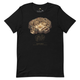
A cutaway of a single Skara Brae house, hearth, twin stone beds, dresser, low doorway, printed alongside the geometry diagram Pyramason actually ran across Orkney and northern Scotland: golden-ratio pairs at p = 0.7131, and collinear alignments at p = 0.0200. Beneath it: Skara Brae, United Kingdom, 59.048714, -3.34175, from our own database.
- Single-house cutaway silhouette: hearth, stone beds and dresser, Skara Brae's most explanatory image
- Geometry diagram carries both regional results, including the collinear one
- Exact coordinates (59.048714, -3.34175) printed beneath the monument and country
- Soft, pre-shrunk cotton in a minimalist gold-on-dark line-art treatment
Why this site. Skara Brae was already old and abandoned before Stonehenge's stone circle went up, and it survives in astonishing domestic detail because its builders had no timber and made the furniture out of stone. Our golden-ratio test finds nothing; the collinear test returns p = 0.0200, which is worth flagging honestly rather than burying. Orkney's monuments sit on a narrow isthmus between two lochs, and narrow land produces alignments for reasons of geography. The number is real. The explanation is probably terrain.
Skara Brae · United Kingdom · 59°02'55.4"N 3°20'30.3"W