
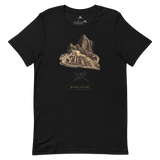


Machu Picchu Site-Emblem T-Shirt, Peru
The terraced ridge between Machu Picchu and Huayna Picchu, the view every visitor recognises from the Watchman's Hut, printed with the geometry diagram Pyramason actually tested against the wider Inca site cluster: a real p-value, not implied mysticism. Beneath it: Machu Picchu, Peru, -13.163333, -72.545556. Those are Pyramason's own catalogued coordinates for the mountain retreat Pachacuti chose and Quechua farmers never stopped calling home.
- Ridge-and-terrace silhouette with Huayna Picchu behind, instantly recognisable even in simplified line form
- Geometry diagram shows Pyramason's real golden-ratio test result across the wider Inca region
- Exact coordinates (-13.163333, -72.545556) printed beneath the monument and country
- Soft, pre-shrunk cotton in a minimalist gold-on-dark line-art treatment
Why this site. Machu Picchu's "lost city" story is a myth. Quechua families never stopped farming its terraces, and a Peruvian farmer signed his name there nine years before its famous 1911 "rediscovery." It's one of the clearest examples in Pyramason's catalogue of a Western discovery narrative overwriting a continuous local one.
Machu Picchu · Peru · 13°09'48.0"S 72°32'44.0"W