


Ring of Brodgar Site-Emblem T-Shirt, Scotland
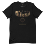
The weathered silhouette of a Brodgar standing stone against open Orkney sky, paired with the geometry diagram Pyramason actually ran across the northern isles: golden-ratio pairs at p = 0.4263, consistent with chance, and collinear alignments at p = 0.0115. Beneath it: Ring of Brodgar, United Kingdom, 59.001482, -3.229723, our own catalogued coordinates.
- Standing-stone silhouette print, engraved gold-on-dark line art
- Geometry diagram carries both regional results rather than only the null one
- Exact coordinates (59.001482, -3.229723) printed beneath the monument and country
- Soft, pre-shrunk cotton, for a landscape that's kept its reasons to itself for 4,000 years
Why this site. The Ring of Brodgar was cut into solid bedrock by hand for a purpose nobody has confirmed, and it returns our strongest collinear signal in Britain at p = 0.0115. We would rather explain it than sell it: the Brodgar monuments sit on a thin neck of land between the Lochs of Harray and Stenness, and when the buildable ground is a strip, the buildings on it will line up. That is geography doing the work. The genuinely unresolved question is what the ring was for, and four thousand years on, nobody knows.
Ring of Brodgar · United Kingdom · 59°00'05.3"N 3°13'47.0"W